|
|
London North Western
Railway:
Midland
Railway:
Stratford
Midland Junction Railway
|
|
The Kingsbury and Water Orton Railway
Extract from 'The Engineer', Edition: 7th May 1909
From May 2nd the Midland Railway Company's Birmingham and
Derby train service has been considerably facilitated and slightly accelerated
by the opening of a short but important 'avoiding' line between Kingsbury and
Water Orton stations, which enables the through express and mineral traffic and
the fast local trains to escape the detour via Whitacre Junction and Forge
Mills, whereby the journey was hitherto accomplished. The new line effects a
saving in distance of It miles; but the difference in mileage compared with the
old route is represented by a proportionately greater saving in time- viz.,
four or five minutes, as the sharp curve at Whitacre Junction on the latter
compels a very marked diminution in the speed of all trains on reaching that
point.
The old distance between Birmingham (New-street) and Derby
via Whitacre is 42¼ miles; but no engineering obstacle ever existed to
the formation of a more direct route. The line was originally constructed to
run via Whitacre for the following reasons. In 1836 three important railway
undertakings were authorised in the Midlands. These were:
- The Midland Counties, extending from the Pinxton
collieries to Leicester and Rugby, with branches from a point near the river
Trent (Trent Junction) to Derby and Nottingham respectively. This system
purposed to make a junction with the London and Birmingham Railway at Rugby,
and so to constitute itself a main line, Rugby to Derby.
- The North Midland, extending from Derby to Leeds via
Normanton.
- The Birmingham and Derby Junction Railway.
The Midland Counties Company was first in the field, and
when the North Midland scheme was promoted it proposed to join up with the
latter system at Clay Cross or Chesterfield. This suggestion greatly alarmed
the North Midland directors, as it threatened to deprive them of some of their
traffic to and from the south. Accordingly, the North Midland Company became
the parent of the Birmingham and Derby Junction Railway, which line was
surveyed to follow a rather indirect route via Whitacre, in order that a branch
might be constructed from thence to Hampton-in-Arden, on the London and
Birmingham Railway, thus giving it an independent route to London without
having to rely upon the Midland Counties system.
The North Midland authorities succeeded in forestalling
their rivals. The London and Birmingham Railway was opened throughout on
September 17th, 1838, and on August 12th, 1839, ordinary traffic between Derby
and Hampton, via Burton, Tamworth, and Whitacre, commenced. The final section
of the Midland Counties route, viz., Leicester to Rugby, was not ready for
service till July 1st, 1840. Therefore, for nearly a year the only route from
Derby and Nottingham to London was via Whitacre and Hampton. The completion of
the alternative Rugby route was followed by a fierce war of rates, during which
the first-class fare for the 38½ miles between Derby and Hampton dropped
to 2 shillings, and it was even proposed to convey through passengers free for
this part of the journey. This race to connect with the London and Birmingham
system accounted for considerable delay in completing the Birmingham and Derby
Railway as between Whitacre and Birmingham (Lawley Street), via Forge Mills,
Water Orton, and Castle Bromwich. This section, 9 miles 71 chains in length,
was not begun till 1841, and its opening took place on February 10th, 1842. Two
years later, the North Midland, Midland Counties, and Birmingham and Derby
Junction Railway Companies amalgamated under the name of 'The Midland Railway
Company,' and shortly afterwards, by virtue of its absorption of the Birmingham
and Gloucester Railway Company, the new company obtained access to the London
and North Western Railway Company's new central station at New Street,
Birmingham, which circumstance, together with the aid of the mixed gauge south
of Gloucester, enabled through trains to be run from Leeds to Bristol.
The short branch, 6½ miles from Whitacre to Hampton,
was deprived of its transcendent importance upon the conclusion of the above
agreement. Today it is only known as a railway curiosity, due to the fact that
the entire service consists of one passenger and one goods trains in each
direction per week day. In deciding to construct a 'cut-off' from the
Birmingham and Derby Railway as between Kingsbury and Water Orton the Midland
Company was not prompted solely by the desire to obviate the check to fast
running exerted by the Whitacre curve of 24 chains radius. Whitacre is also the
junction where the branch to Nuneaton and Wigston begins. The track capacity
having already been augmented between Birmingham and Water Orton, it was
realised that the same measure of relief ought to be extended as far as
Whitacre. Thus the idea presented itself that both objects could be better
achieved by the construction of a short avoiding railway for the Birmingham and
Derby traffic. Here it should be explained that as originally made, the curve
at Whitacre was of a mile radius, and it was not until the Whitacre and
Nuneaton line was constructed in 1861 that the present sharp curve was put in,
with a view to providing a junction station that should serve both the Derby
and Birmingham line and the Nuneaton line, as well as the Hampton branch.
The new line, the construction of which was begun in April
1907, is 3 miles 68 chains in length, and possesses as yet no intermediate
station. Save for a curve at each extremity, viz., of 95 chains radius at the
Kingsbury end, and of 90 chains radius at the Water Orton, the route will be
absolutely straight. The ruling gradient is 1 in 330, and the steepest 1 in
300. Notwithstanding the short distance covered, the engineering difficulties
encountered were rather remarkable. For two-thirds of its length the railway
traverses a flood area in connection with the river Tame, which itself is
crossed twice. In passing through these meadows and low lying land the
foundations of the permanent structures had to be sunk to a considerable depth,
and in several cases running sand was found. There are as many as thirty
bridges over and under the railway, together with a number of culverts, an
astonishing total for such a. short stretch of line in a rural district. There
are eight important over-bridges either carrying main roads or belonging to the
occupation category, several of which are notable for their long approaches,
and also two steel foot-bridges, one of which at Water Orton station has a span
of 80ft. There are nine important under-bridges, including two river viaducts,
and a sewage outfall conduit.
In the majority of cases the bridges are constructed of
brindled brickwork, but the two viaducts over the Tame have steel
superstructures. Two cuttings had to be made. Cutting No 1 is one mile in
length and passes through gravel and red marl, which contained a great quantity
of moisture. This cutting entailed the excavation of 200,000 cubic yards. It
attains a depth of 17ft, and its slopes are as 1½ to 1. Cutting No. 2 is
a quarter of a mile long, and contained 60,000 cubic yards. The earth thus
obtained was subsequently used for the purpose of forming the embankments to
the line, and was also requisitioned for making several large road approaches.
The most important bank extends from 7 chains to 1 mile 47½ chains from
Kingsbury station, and its greatest height is 20ft. Although the line is
furnished with two tracks, in that part of it which passes through Lord
Norton's estate at Hams Hall the conditions of purchase were that sufficient
land should be at once acquired to meet widening requirements at any future
period. Accordingly, on this stretch, which is about 1½ miles in length,
cutting No 1 has been excavated to double the ordinary width, and the over
bridges have been built with two railway openings.
The old station at Water Orton has been demolished, and a
new one constructed on the island platform principle upon a site nearer to
Birmingham, while the old stone over bridge, which now gives access to the
station, has been almost entirely rebuilt to suit the alterations to the
permanent way. This latter is of the most substantial type employed by the
Midland Railway, consisting of 45ft steel bull-headed rails, weighing 100 lb
per yard, 54 lb chairs, specially selected granite ballast, and wider sleepers
(12 inches instead of 10 inches) on either side of the rail joints. Extending
along the full length of the line is a strong creosoted fence, in addition to
which there is an inner quickset fence. For signalling purposes the line
constitutes a single block section, and it is track-circuited in order to place
an electric lock upon the fixed signals, which comprise 'home', 'outer home',
'distant', and 'starting' signalling points. Lastly, the equipment of this
imposing looking railway includes the innovation of the erection of commodious
platelayers' cabins at stated intervals. The Kingsbury and Water Orton Railway
has been built from plans prepared by Mr WB Worthington, Chief Engineer to the
Midland Railway Company, assisted by Mr JL Lowe, Chief Engineer for New Works,
and the whole undertaking has been carried out under the supervision of Mr John
Brunton, Resident Engineer, with offices at Water Orton. The contractors are JD
Nowell and Sons, who have had about 400 men employed on the works since April,
1907.
The faster passenger traffic and express freight services
used the new direct route to Water Orton whereas the slower freight services
such as the coal trains used the line via Whitacre. Within the triangle formed
by the slow and fast lines together with the Nuneaton line to Birmingham, was
Hams Hall Power Station. As would expected, the coal required to fire the Power
Station was brought in by rail but its connection was only via the slow lines
and the line to Nuneaton.
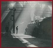
1907 Views of the Midland Railway's recently opened
Kingsbury to Water Orton 'Cut Off'
1950s and 1960s views of Kingsbury Junction
Ordnance Survey Maps and Schematic Plans
|