|
|
 |
|
|
London North Western
Railway:
Midland
Railway:
Stratford
Midland Junction Railway
|
|
LMS Route: Birmingham New Street to Tamworth
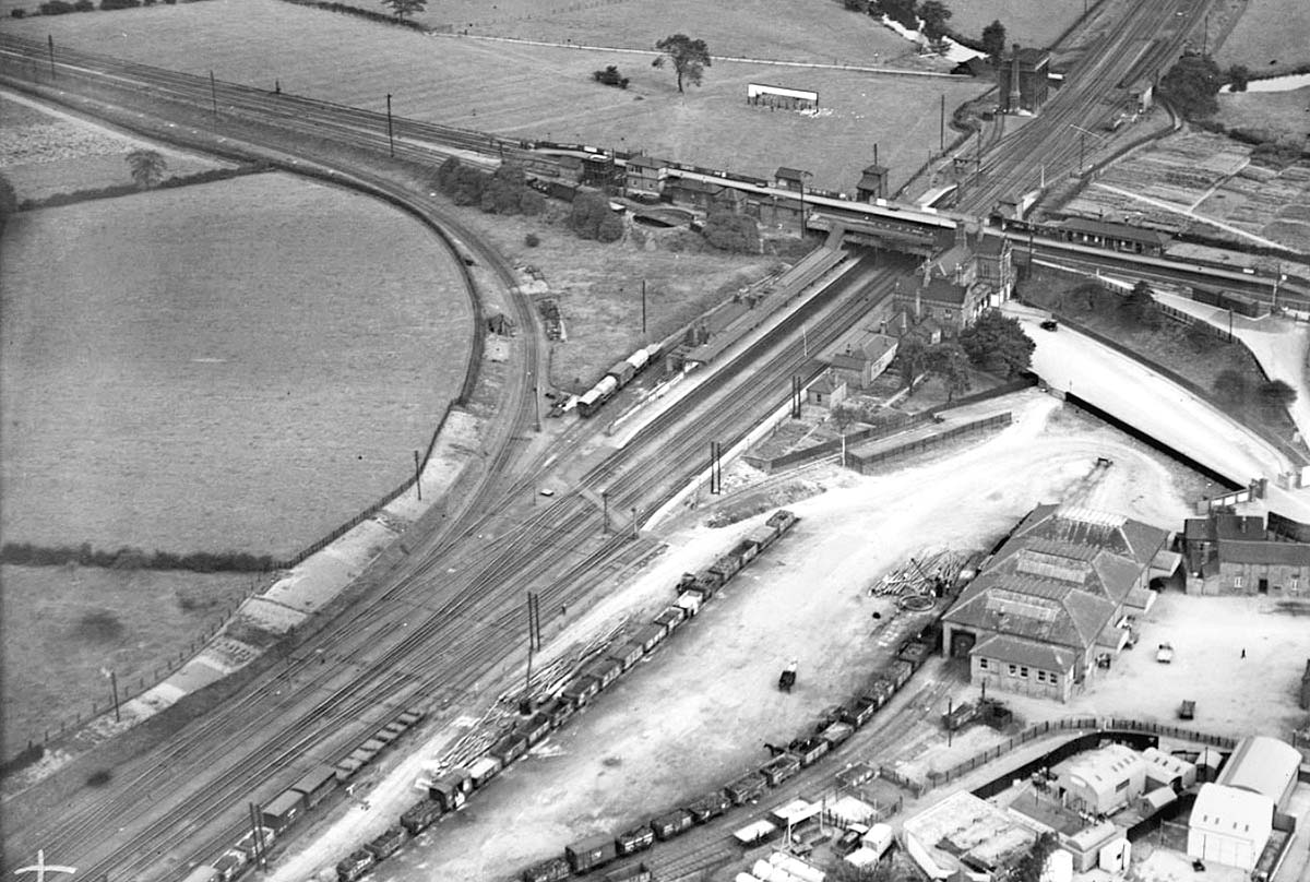
Tamworth High Level Station: mrthl4122
An aerial view showing Tamworth High Level and Low Level
stations and the connecting line between the two. The photograph, taken in
1928, is facing east and showing on the left, the single-track west chord line
between the LNWR and the MR. The east chord line earthworks are right out of
the picture at the top. It also shows the TVR 'Livock' station building, the
stationmaster7s house, and lower right, the extensive goods warehouse. The No 2
signal box is out of the picture at the bottom. The River Anker bridge can be
seen to the north of the MR, as can the LNWR water tower with its tall chimney
beside the bridge. The goods shed in the bottom right hand corner is a much
more impressive structure than indicated on the map seen in image 'lnwr_tam1745'. Tamworth's goods yard has very
generous open spaces; as is evident from the space between the goods shed and
the siding on the left where wagons are seen stabled.
Britain from Above - EPW024629
 back back
|
|
|