|
|
 |
|
|
London North Western
Railway:
Midland
Railway:
Stratford
Midland Junction Railway
|
|
LMS Route: Nuneaton to Birmingham New Street
Shustoke Station: mr_shus1059
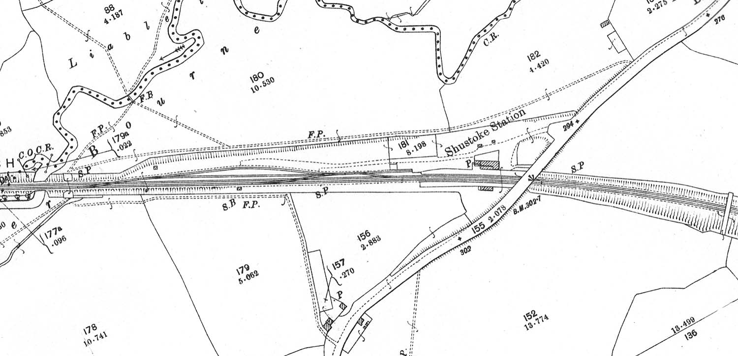
A 1902 25 inch to the mile Ordnance Survey map showing
Shustoke station and two siding goods yard. The access to the station and the
goods yard was off Coleshill Road which crossed the railway on the Nuneaton
side of the station. The station's signal box was located on the down line on
the Whitacre side of the station and centred on the goods yard which was
opposite. Unlike the 1924 OS map there are no letters 'W M' at the entrance to
the yard to show where the weighbridge was located however, the two buildings
located next to the lettering on the 1924 map exist so its reasonable to assume
that the weighbridge did exist. The cattle dock is located to the left of the
station building, accessed by a short spur from the two loop sidings. On the
extreme right of the map is a farmer's possession bridge.
 back back
|
|
|