|
|
 |
|
|
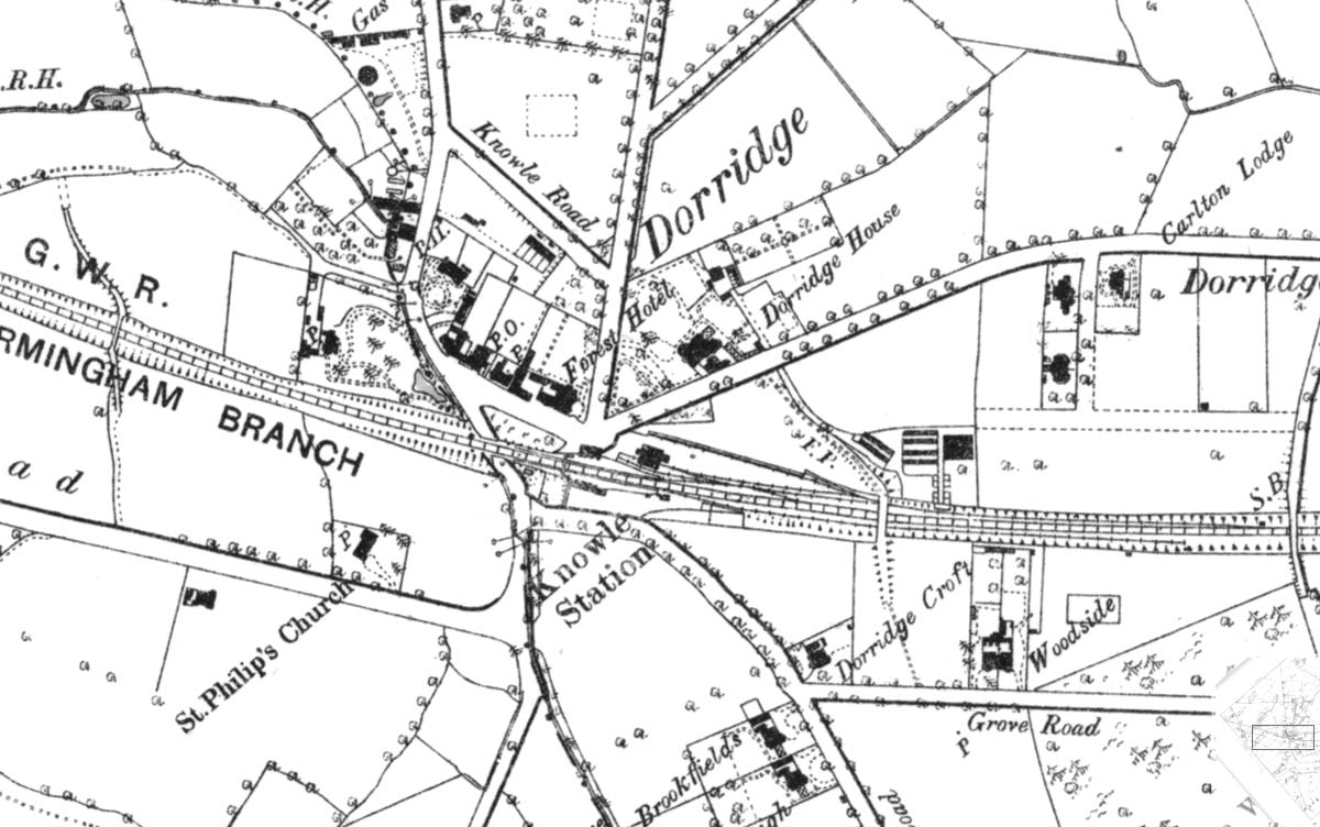
GWR Route: Banbury to Wolverhampton
Knowle & Dorridge: gwrkd2803
An 1888 Ordnance Survey map showing Knowle and Dorridge's
station building and goods yard being adjacent to the up line. A refuge siding
has been installed off the down main to the south of the station. The map
information states that it was actually surveyed in 1886 but published in
1888.
 back back
|
|
|