·  LMS  ·  GWR  ·  LNER  ·  Misc  ·  Stations  ·  What's New  ·  Video  ·  Guestbook  ·  About

GWR Route: Banbury to Wolverhampton

Bentley Heath Crossing: gwrbh3933

A 1913-1914 25 Inch to the Mile Ordnance Survey Map showing Bentley Crossing and the outskirts of Knowle & Dorridge station

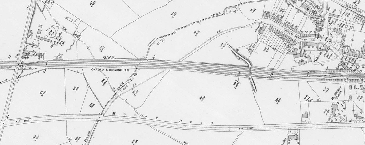
A 1913-1914 25 Inch to the Mile Ordnance Survey Map showing Bentley Crossing and on the right, the outskirts of Knowle & Dorridge station. The map was published in 1917.

back