|
|
 |
|
|
GWR Route: North Warwickshire Line
GWR Route: Banbury to Wolverhampton
Bordesley Station: gwrbg3998
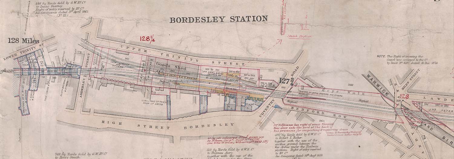 |
This Great Western Railway Land Survey Plan of Bordesley
Station dates from 1878. The plan shows the land purchased by the Birmingham
& Oxford Junction Railway to construct this railway. These purchases are
marked in blue, together with any further additions or disposals that took
place up to 1878. Those areas marked in red are the subsequent land purchases
and disposals associated with the later development of the site and includes
the land purchases necessary for the later quadrupling of the main line. The
plan shows the original station layout with its entrance from the High Street.
The covered Goods Shed and Cattle Pens adjacent to a retaining wall above Upper
Trinity Street can also be seen. On the left is the junction for the track laid
on the unused Duddeston Viaduct to Curzon Street Station and also the start of
the original double track arrangement over the Bordesley Viaduct to Birmingham
City Centre (prior to this viaduct being widened). On the right are the bridges
over the Warwick & Birmingham Canal and Sandy Lane. The original mileage
from Paddington Station is given in black figures, but revised mileage in red
figures are thought to indicate the slightly increased mileage following the
relocation of the London Terminus.
Robert Ferris
|
|
|